- copy")


 System Advantages

shot

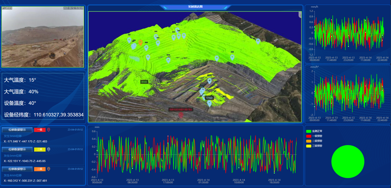
Live View 3D Visualization

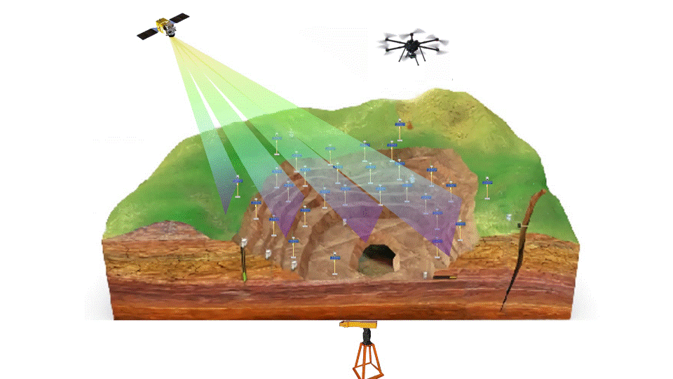
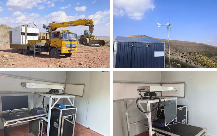
Integrated air-to-ground monitoring

Comply with the latest requirements of the Safety Authority specification

Short-range heavy rainfall forecast
Integrated Airborne and Spaceborne Monitoring System
system architecture
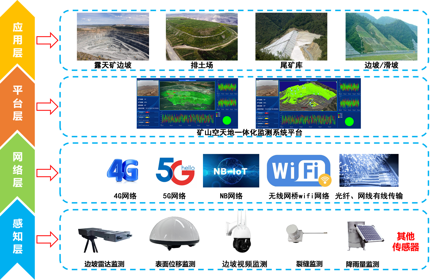
system platform
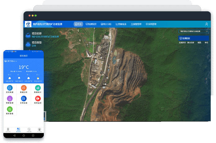

One Map Platform
The platform provides GIS panoramic view based on global vision, digital twin technology integration application, the platform is based on the private cloud deployment of global spatial resources big data pool for monitoring key business indicators and key nodes, monitoring content in the form of "a map" for visual display, GIS panoramic display provides all regulatory data, resources, dynamic, Static information on the same screen linkage display

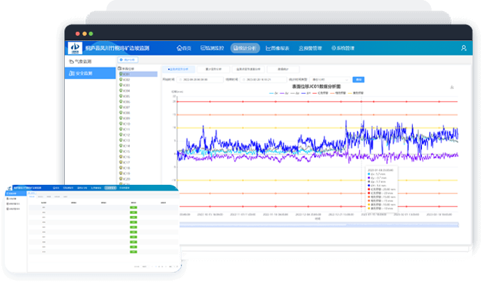
Monitoring risk analysis
Comprehensive monitoring data to establish mine slope safety assessment algorithms, according to the set safety model warning thresholds, deformation rate analysis, and automatically issue early warning alarms

Monitoring and early warning mobile
WeChat small program and mobile APP multi-channel display monitoring project, support inspection data entry, flexible operation
Risk Analysis Functional Module

Fact Sheet
Monitoring the overall status of early warning in the region
GIS + 3D Visualization Integration
Beidou + geotechnical, meteorological and other multi-source sensor fusion

warning message
Red, yellow, orange and blue warning information
Comprehensive analysis of the causes of early warning
Leveled Alert Push
SMS, email and other push methods

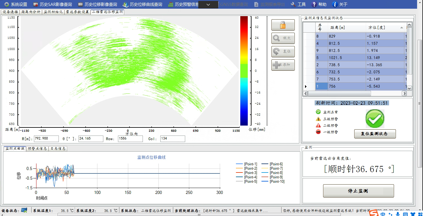
data analysis
Trend analysis of Beidou, geotechnical monitoring data
Multi-source data correlation analysis
Improved tangent angle analysis
Stability assessment analysis of the monitoring area

Automatic generation of monitoring reports
Automatically generated by the system according to the settings
Daily, weekly, monthly and annual monitoring reports
Slope radar monitoring platform
Intelligent Storage and Management
Support data intelligent storage, data real-time update, data engineering management, data export function
High-precision 3D display
With high-precision national topographic imagery, monitoring data is displayed in three dimensions.
Diversified Data Presentation
Heat diagrams and curves of deformation displacement, velocity, acceleration, and dynamic demonstration of deformation process.
Slope radar analysis function
Artificial Intelligence Early Warning and Assessment
Embedded with professional geological model and artificial intelligence model for early warning and assessment.
around the clock
24-hour continuous monitoring, adapted to all types of climatic conditions
Intelligent Early Warning
Integration of sound and light warning, automatic generation of warning reports
Diversified topographic mapping and surveying
It can be used for pointing, line drawing and screen operation, and has the functions of distance measurement, area measurement and triangulation.
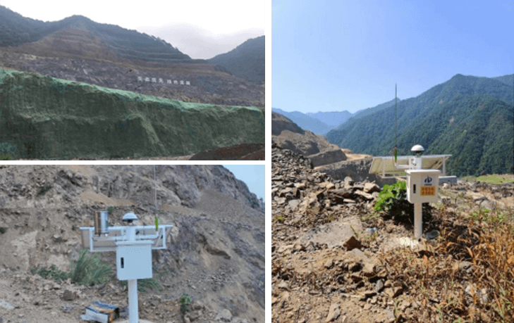
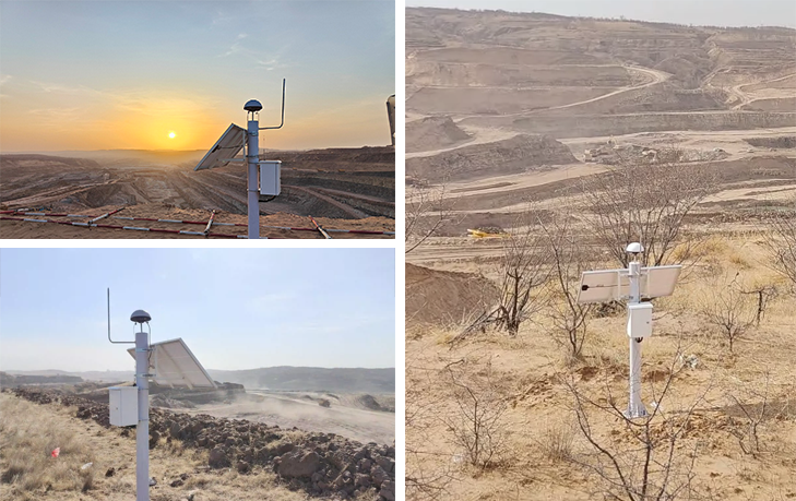
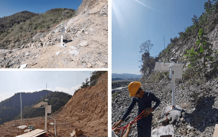
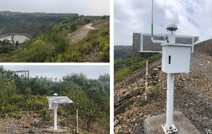
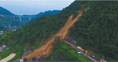
Project Cases
Other solutions


Company Profile
Ltd. was founded in 2012 in Nanjing by Nanjing science and technology innovation and entrepreneurship leader, relying on Nanjing University of Information Engineering, Anhui University of Science and Technology, Hohai University and other industry colleges and universities of advanced science and technology, high-level talent and other advantageous resources, is the government, industry, academia and research closely integrated with the national high-tech, dual-soft certified enterprises, with the qualification of surveying and mapping, through the ISO9001 quality The company has passed ISO9001 quality management system certification. The company focuses on meteorology and water conservancy, intelligent mining, intelligent road and bridge, natural disasters, resources and environment, public security monitoring and early warning areas, adhering to the concept of "precision, specialization, integration, and specialization", and advocating the spirit of "stopping at excellence", to provide excellent technical solutions, system integration, and high-end platforms for the government, enterprises and public institutions. We provide excellent technical solutions, system integration and high-end platform services for governments, enterprises and public institutions. The company set up branches or offices in Nanchang, Xi'an, Guiyang, Wuxi, service radiation in East China, Central China, Northwest China, Southwest China market, for the relevant departments of provinces and cities to provide high-quality, high-quality pre-sales and after-sales service.
The company insists on independent innovation, independently researched and developed safety monitoring and early warning systems for reservoirs, tailing ponds, pylons, slopes, bridges, etc., and provided supporting equipment systems and technical support for major events such as the 2016 Hangzhou G20 Summit and the 2018 Qingdao SCO Summit for many times, and the core products have passed the testing of national professional institutions, and the key technologies have been authorized by patents. The company owns and is authorized to use more than 30 patents, and has registered more than 20 software copyrights. Its scientific research achievements and system products have won a number of awards, such as the Second Prize of China's Satellite Navigation and Positioning Scientific and Technological Advancement, the First Prize of Shaanxi Province's Surveying, Mapping and Geoinformation Scientific and Technological Advancement, the Second Prize of Jiangsu Province's Surveying, Mapping and Geoinformation Scientific and Technological Advancement, and the Third Prize of Anhui Provincial Science and Technology Award. The company has established cooperative relationship with more than 100 units including government departments, listed companies, provincial and municipal industrial institutions, etc. The system products and technologies are widely used in more than 300 projects in 18 provinces such as Jiangsu, Anhui, Beijing, Hubei, Hunan, Yunnan, Shandong, Guizhou, Zhejiang, Qinghai, Inner Mongolia, Fujian, Jiangxi, Guangdong, etc., which have been highly affirmed by the user units and government departments. Many media, such as Jiangsu Provincial News Network, Nanjing TV, Xining TV and so on, have reported on the company in all aspects.
The company actively strengthens the cooperation and contact with universities, and is now the postgraduate training base of Nanjing University of Information Engineering, Nanjing University of Technology, the practice base of postgraduate students of Anhui University of Science and Technology, and has been recognized as a double unit of Remote Sensing and Surveying and Mapping Engineering School of Nanjing University of Information Engineering, and with Wuhan University, the Chinese Academy of Sciences, the China University of Mining and Technology, Southeast University, Hohai University, the University of New South Wales in Australia, and other domestic and foreign famous universities to establish close cooperative relations. We have established close cooperation relationship with famous universities in China and abroad, such as Wuhan University, Chinese Academy of Sciences, China University of Mining and Technology, Southeast University, Hohai University and University of New South Wales, Australia. Team members have been awarded the title of "Six Talent Peaks" high-level talents in Jiangsu Province, Advanced Individuals in Nanjing Innovation and Entrepreneurship Competition, Nanjing May 1st Labor Medal, Top Ten Scientific and Technological Youths in Surveying, Mapping and Geographic Information of Jiangsu Province, etc. Provincial and municipal leaders such as the then Secretary of CPC Youth League Committee of Jiangsu Province, Mr. Wang Wei, have visited our company for many times, and have guided our work, and we have also received a number of awards from Nanjing TV, Xining TV, Xining Net TV, and Nanjing TV. Nanjing TV station, Xining TV station, NetEase and other media have reported the team's achievements many times, which is highly recognized by the society and the government.
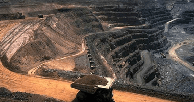
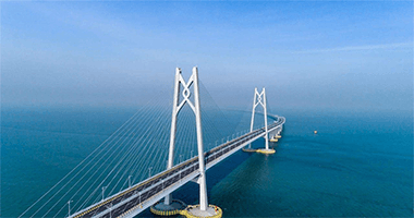
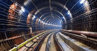
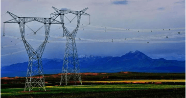
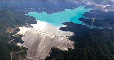
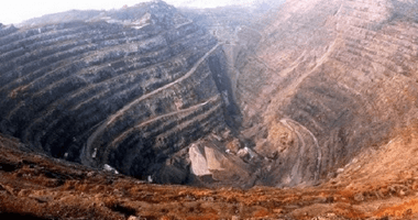
Application scope of the system platform: safety monitoring and early warning of reservoirs, smart mines, river dams, landslides, tailing ponds, slopes, coal mine subsidence zones, bridges, indoor and outdoor safety of commercial complexes, electric power, telecommunication pylons, high-rise buildings, dangerous houses, high-speed railroads' safe operation, subway tunnels, and so on.
Regional coverage: Jiangsu, Anhui, Beijing, Hubei, Hunan, Yunnan, Shandong, Guizhou, Zhejiang, Qinghai, Inner Mongolia, Fujian, Jiangxi and other 20 provinces, more than 300 projects.
Customer-centered, integrity-based, pragmatic as a source of unity as the basis for cohesion and development!
Our Philosophy
☆ Scientific and technological innovation: conceptual innovation as the forerunner, strategic innovation as the direction, organizational innovation as the guarantee, scientific and technological innovation as the means, market innovation as the goal
☆ Strive for Entrepreneurship: Weaving Dreams with Tenacity, Casting Brilliance with Action
☆ Integrity and Pragmatism: Integrity as the foundation and pragmatism as the source.
☆ Solidarity and collaboration: solidarity as the basis for cohesive efforts to seek development
☆Adhering to the development concepts of "Prioritizing Talent", "Specialization, Newness, and Specialty", and "Achieving the Best".
☆Adhering to the market competition strategy of "providing high-end knowledge services with a focus on customers".
☆Integration of resources such as "talents, universities, industries, and capital" to enhance the benefits of market transformation.
☆Always adhering to the "driving force of innovation" to achieve sustainable development


 Su Gong Network Security No. 32011202000665